Laguna NRCD
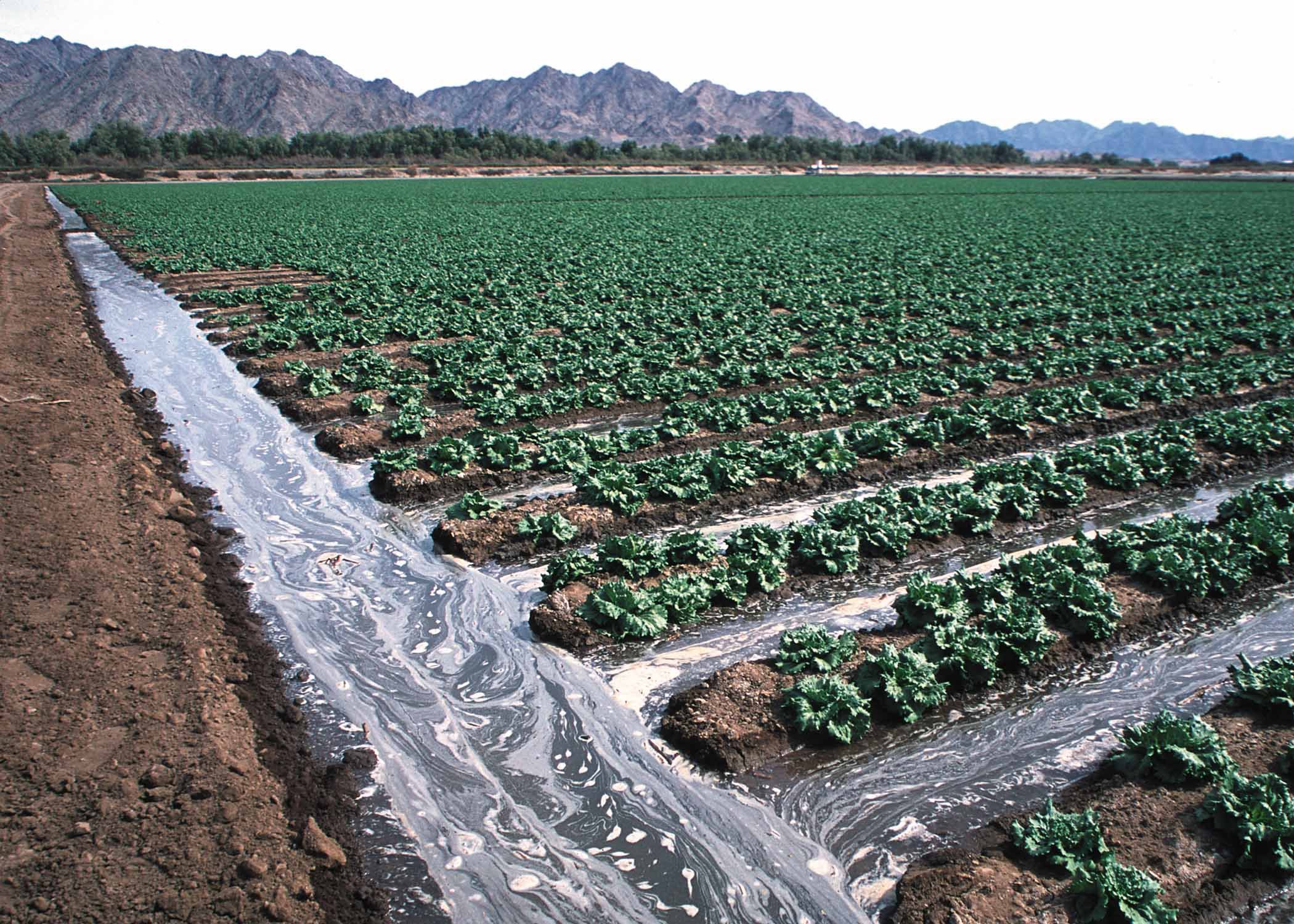
The Laguna NRCD is located along the Colorado River on Arizona's western border. The District includes desert shrublands and irrigated lands along the River. Rangelands in the District are mainly government-owned and generally have low productivity and are mainly used for seasonal grazing when winter rains are good. Consequently, the District's activities are concentrated on irrigated agriculture, especially vegetables.
Known as the “Winter Vegetable Capital of the World” the farmlands within the Laguna Natural Resources Conservation District live up to the name. The 90,000 irrigated acres in the Yuma, North Gila, and South Gila Valleys contribute to the multi-billion dollar crops of head lettuce, leaf lettuce, cauliflower, broccoli, seed crops, herbs, celery, mixed greens, and a multitude of other vegetable crops shipped throughout the world. The alluvial silt, clay, and loam farmlands were formed by both the Colorado and Gila Rivers.
Sustainable farming practices are a concern for the District, as water usage and water rights are constantly being changed. Also, Tamarisk is of concern in the area as an invasive species. The salt cedar beetle, however, has moved into the area, helping to defoliate the Tamarisk and aid the growth of native plants.
Resource Concerns:
Conservation of Water
Food Safety
Coordination
Rural and Urban Education
PM-10 Compliance
Soil Engineering
Conservation Practices:
Irrigation System Reorganization
Irrigation Ditch Lining
Land Leveling and Soil Swap
Irrigation Sprinkler Systems
Conservation Cropping Systems
Conservation Crop Rotation Plans
Nominations for District Supervisor Are Now Open!
The open seat is for a new 6-year term. To be eligible, a candidate must be 18 years of age, a resident of the District, a registered voter in the State of Arizona, and have a Cooperator Agreement on file.
A regular candidate nomination petition requires the signatures of district cooperators, while a write-in nomination petition does not require signatures.
Write-in nomination petitions must be filed by March 25, 2024
Regular nomination petitions must be filed by April 24, 2024
Election Day is May 4, 2024
Nomination Petitions must be sent to the NRCD Board of Supervisors by emailing or calling the District’s point of contact listed on this webpage. Once you provide your email address, additional candidate forms will be emailed to you to complete the nomination process.
If you have any questions regarding cooperator agreements, nomination petitions, or filing, please send an email or call the District point of contact listed on this webpage.
-
What: Laguna Natural Resource Conservation District
When: May 16, 2024@ 12:00PM
Where: USDA service center Conference room
2197 S 4th Avenue Suite 204, Yuma, AZ 85364Agenda: Click Here
-
January 2024
Board of Supervisors
Sheryl Christenson, Chair
Steve McCollum, Supervisor
Bruce Easterday, Supervisor
Orson Bevins, Supervisor
Contact Info
Sheryl Christenson